
Trohn Enright-Randolph and much of his surveyor’s office staff feel their job can turn them into therapists at times. They won’t always be able to help people with their needs, but they can give them recommendations and at the very least, a handshake.
Enright-Randoph is running unopposed for re-election to the position, which will see him continue his push for modernizing the office and increasing collaboration between county departments. He led the department’s push to adopt geographic information systems, creating dedicated positions and a division for the mapping tool.
That’s just one of the organizational changes he’s made, transforming the office’s traditional structure to include a professional surveyor, survey technician, an office manager, a GIS technician and GIS coordinator, along with many more part-time roles over the years. Many people have gone through the office, he said, and gained experience that has helped them land other roles.
The transformation has included digitizing records in an ongoing pursuit, turning maps once built on stacks and stacks of paper into numbers that his models can process in minutes.
The responsibilities of the role include managing property and geographic boundaries, reviewing previously plotted ones and managing much more. It’s hard to overstate the amount of work that goes into replotting just one boundary.
Enright-Randolph views his job as one of public service, which is why he’s happy it’s an elected position. It would be hard to be appointed, he said, and be accountable to an appointment rather than the public. He’s also the only official elected to the planning commission, along with positions on the storm water management and drainage boards.
He said the best part of his job is the moments where he’s able to help people. He keeps a handwritten thank you note on his desk. Post-it notes of affirmation hang off his monitor. He runs to meditate and hold himself accountable.
He first began under the tutelage of his uncle, who previously served as county surveyor.
After graduating from Ivy Tech in Bloomington with a degree in applied science in design technology in 2004, he said he was walking down the hill his mom lived at the top of when his uncle pulled up in his truck.
Asked on the spot whether he was looking for a job, his uncle offered him the position of field assistant in Monroe County. Everything else kind of faded as he became more and more involved. He stepped into his current role in 2016.
“And then 12 years later, I kind of found myself in a position to put my name in the hat, to be caucused in,” he said. “And that's kind of what happened.”
The surveyor’s office has expanded significantly since just a few years ago: boxes on boxes of papers on papers laid out in a cramped space in the health department’s building. Now it’s a more modern looking office at City Hall with an open desk layout and room for filings, books and trinkets.

Trinkets are pictured Oct. 16, 2024, in Trohn Enright-Randolph’s office. The painted antler belonged to his uncle, who was once also Monroe County surveyor.
Enright-Randolph’s institutional knowledge has likewise expanded. He said that nearly every board meeting he goes to, he knows each sitting member’s name and about half of the audience’s. That’s come from decades of experience, starting from 2005.
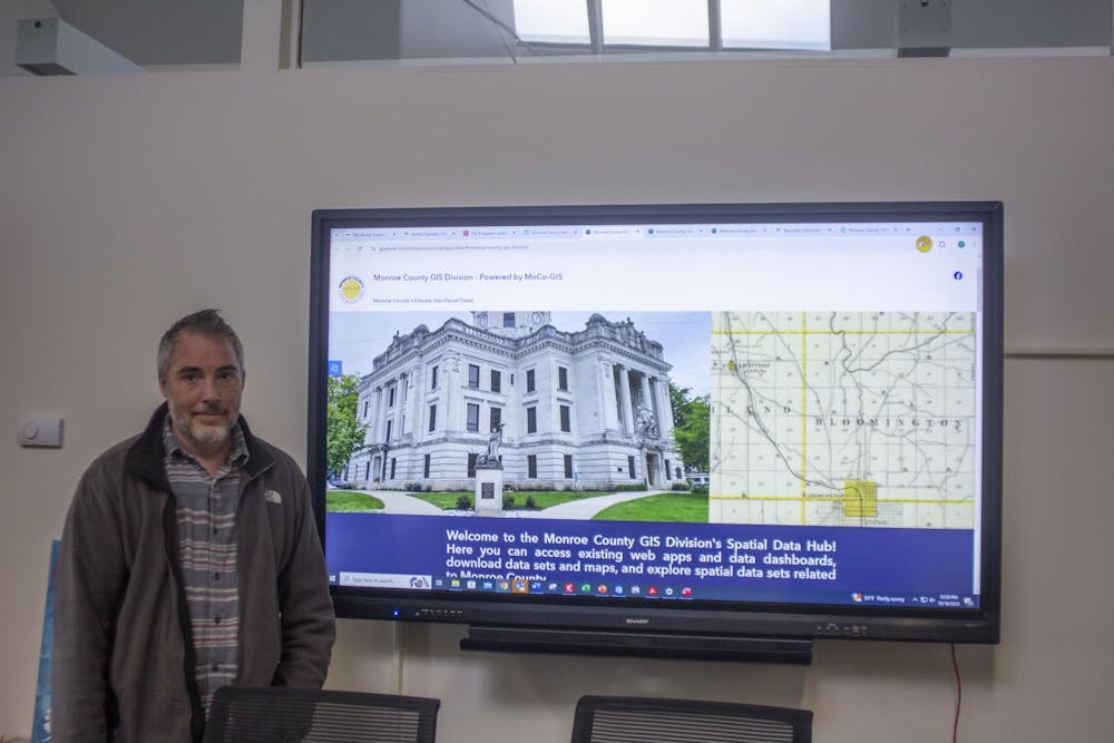
He attributed much of the office’s modernization to his uncle, who first asked him to integrate GIS into the surveyor’s purview. Most county surveyor offices are not nearly as well-staffed or consistent as his, he said. The GIS division alone has been touted as an example for the rest of the state.
Featured on the GIS division’s page are topographic maps, historical maps and all kinds of other data. Going through old data tends to result in more publicly available maps — transparency is the goal.
Here’s where collaboration plays in. They’ve been working with other Monroe County departments to bring GIS systems into play, for example: a map of food inspections.
His office has it all: the old guard and the new blood, all of whom are pushing the surveyor’s office forward. Mike Sheppard, the office’s professional surveyor, said he was just hoping to plot out as many corners on the mile-by-mile demarcations of Monroe County as he could until he retires.
He’s also looking to institute a longevity program that can help pay for the cost of employees seeking education or certification surveyors, one that current Survey Technician Jason George said he would plan to use. Donna Barbrick has been office manager for more than 20 years, and Enright-Randolph said she has helped play a significant role in the office’s growth.
John Baeten, the office’s GIS coordinator, was formerly an IU professor in the geography department. His academic research had impacts, he said, but in his new role, he’s able to do similar amounts of research with much broader impacts on the community he lives in.
For Enright-Randolph, the well-being of his staff is front and center. He repeatedly highlighted his work to raise salaries — far higher than the state’s average, and often above his own for his staff — and for the county to pay for educational opportunities.
The job of his team is to understand the physical texture of Monroe County (along with its invisible human-made demarcations, like property lines); to find hundred-year-old stones that others in past years accidentally glossed over. But he sees it more through a human-centered lens. There’s so much work that goes into the surveyor’s office many people may not know about. It’s multidisciplinary, it’s a think tank. The staff all agreed as Baeten called the work a “lifestyle.”
CORRECTION: This story was updated to reflect that Enright-Randolph is the only official directly elected to the planning commission, while other elected officials also serve on the board.


